Warton-with-Lindeth
![]()
![]()
Warton-with-Lindeth
Early History
 Warton has long provided homes to people. On the rocky outcrop of Warton Crag, standing 163 metres (535ft) high to the North of the present village of Warton, caves provided shelter from Palaeolithic times, more than 10,000 years ago and on the summit of the Crag people in the Iron Age built a hill fort, with ramparts and ditches, huts and tumuli. Objects made of horn, bone, bronze, iron and pottery have been found there. Other archaeological finds include a stone axe from Langdale in the Lake District as used by Neolithic farmers to clear land , the Keer Valley may have been used as a route to the sea for their export also an iron sword with a bronze hilt and sheath, probably made in Romano-British times.
Middle Ages
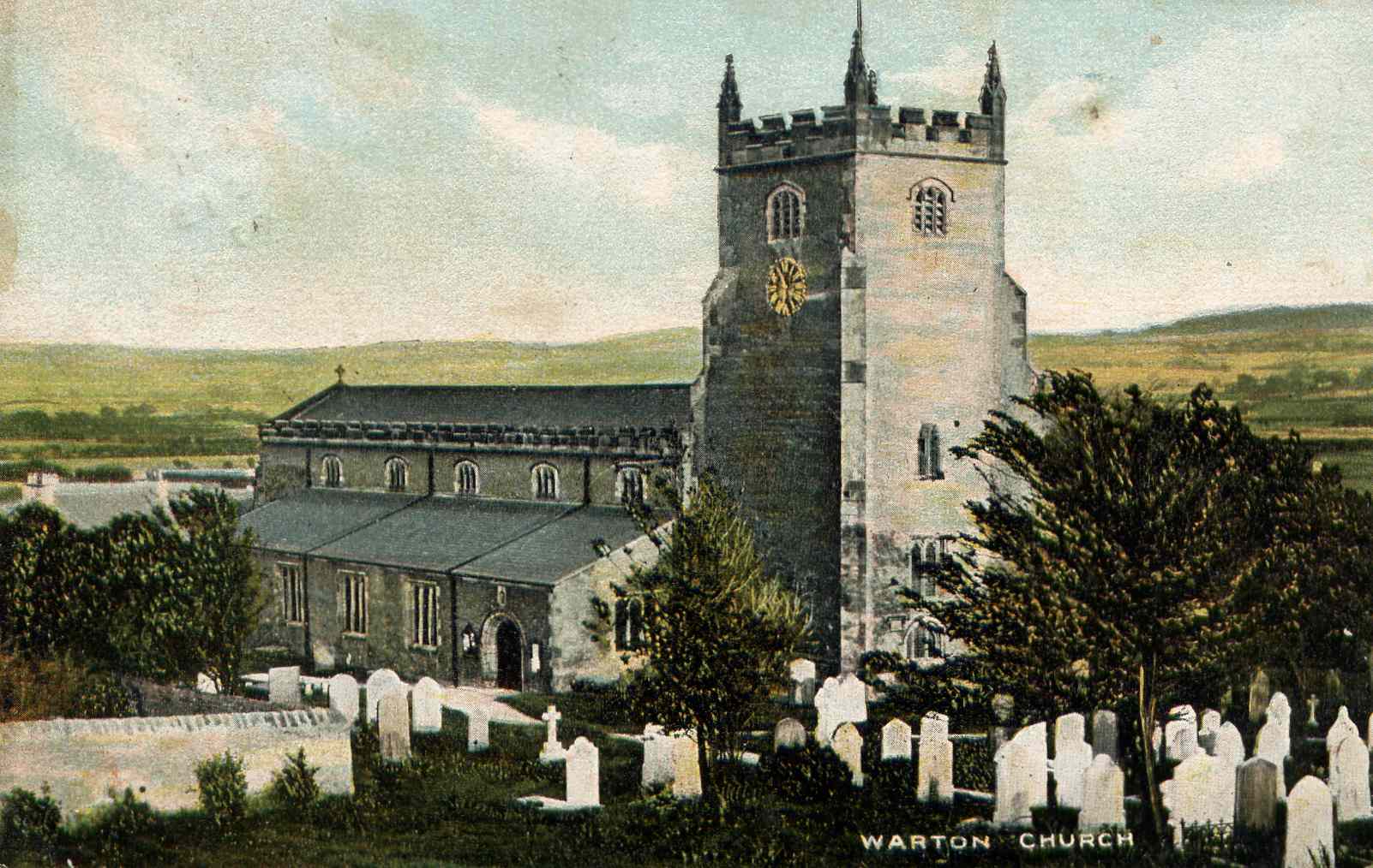 Warton Parish Church was in existence by 1208, but its dedication to St Oswald, a 7th century Christian King and Martyr and the circular shape of the churchyard, as seen on the tithe map of 1846, indicates Anglo-Saxon origins. St Oswald is also commemorated in Senset Well, off Borwick Lane. The oldest part of the present building is 14th century.
The Domesday Book shows that Warton was part of the King’s land in Yorkshire, it was one of 12 manors held by Thorfinnr, Lord of Austwick, they were worth 43 carucates to the geld. It became part of the Barony of Kendal, with castles in Kendal and Mourholme. The site of Mourholme castle was at Dock Acres, under what is now Pine Lake, the flooded gravel pit. In 1200 King John granted a charter to Gilbert FitzReinfred for a Wednesday market.
 Later in the 13th century, the Lord of the Manor granted a borough charter to Warton, 44 burgage plots, each measuring one rood, ¼ acre, were laid out on either side of Main Street, from Crag Road to Coach Road and Senset Well Lane, the burgesses being freed from services to the Lord of the Manor. Their pattern can still be seen, with the access lanes between the houses going to Back Lane, the site of the common arable fields, where they each had one acre of land. Warton’s Manor Court was held in the Rectory, the great hall with service rooms and an upper floor, built in the late 13th or early 14th century by the rector, Marmaduke de Thweng’s sons. However Warton failed to prosper as a borough, it reached its peak in the 14th century and by the 16th century had ceased to be recognised as a town.
School
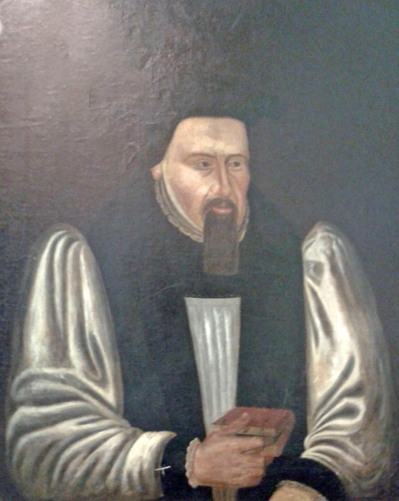
However the needs of local children and elderly people were not neglected and in 1594 a Free Grammar School, Deo et bonis literis (For God and good education) and the Hospital of Jesus, almshouses for six poor men, were founded by Matthew Hutton, the Charter being granted by Queen Elizabeth I. Matthew Hutton, born in 1529 in Priest Hutton, studied at Cambridge, where he distinguished himself by his ability in the theological disputations before Queen Elizabeth and established himself as an able scholar and preacher. He became Bishop of Duham in 1594 and Archbishop of York in 1595. Part of the old school at Cross Bank is now a Brewery, while primary school children have enjoyed the facilities of a modern Archbishop Hutton School in Back Lane since 1991.
George Washington's Ancestry
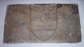 There is a tradition of flying the Stars and Stripes flag of the USA on the 4th July every year to commemorate the first president of America, whose ancestors came from Warton and whose seal of two bars and three mullets, which can be seen on a stone in the church, may have inspired the design of the American flag.
Industrial Revolution
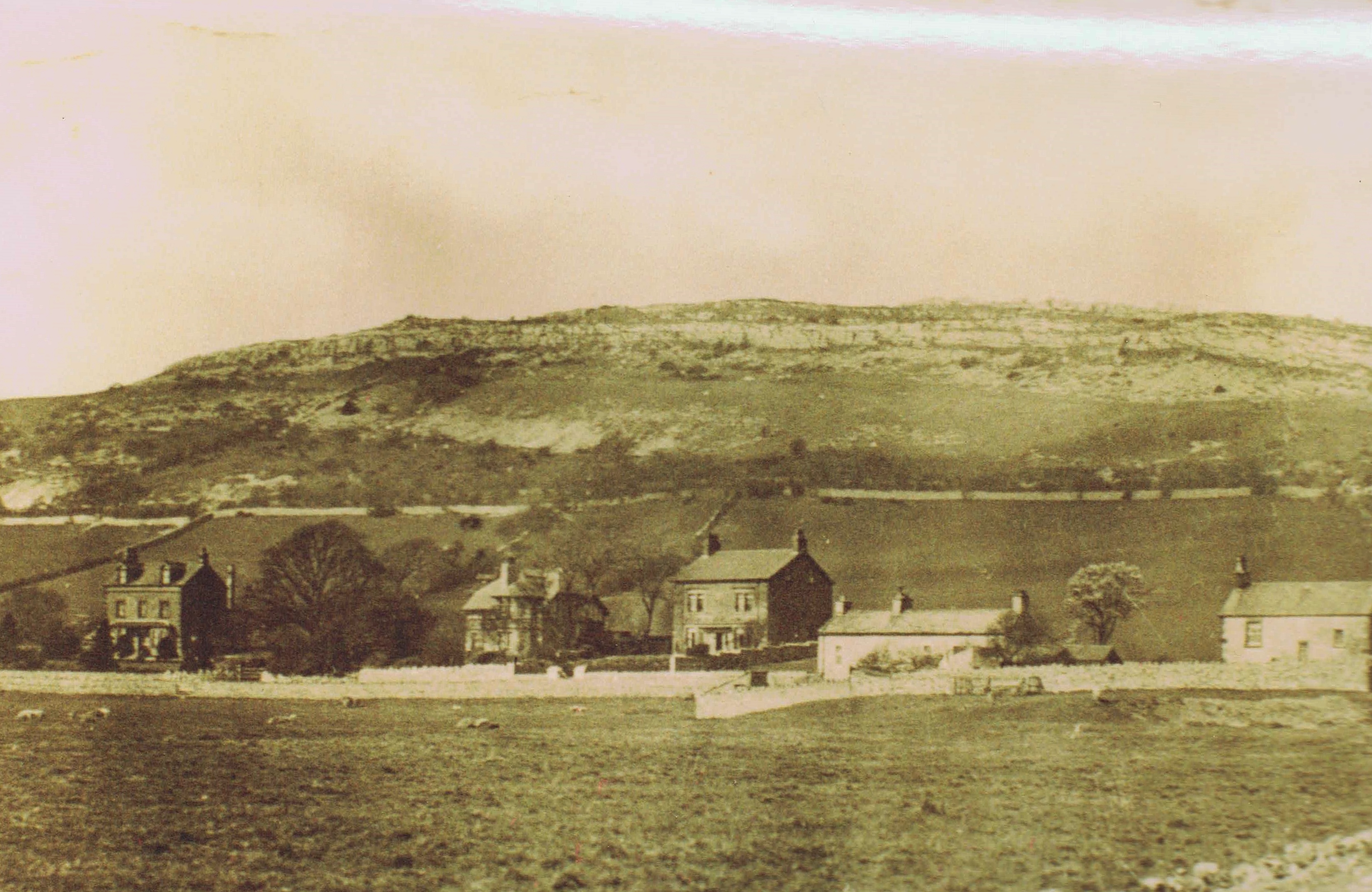
People in Warton had been involved with farming, weaving, fishing, quarrying and limestone burning, with some mining on Warton Crag and some ship building. But the coming of the Lancaster Kendal canal, turnpike roads and railways, from the 1790s onwards, which bypassed Warton, led to a change in the balance of population and in employment opportunities. Carnforth overtook Warton as the township with the largest population in the decade between 1861 and 1871. Carnforth Ironworks opened in 1865 and Warton’s population was swelled by iron workers living in houses built for them by the Company in Dudley, the part of Millhead on the Warton side of the river Keer, Bessemer Terrace, Albert Street and William Street.
Warton’s resources of stone and gravel were used when England’s first motorway was built, the Preston bye-pass in 1958 and the Lancaster bye-pass in 1960. The quarries are now part of the Warton Crag Nature Reserve and the gravel pits are flooded and feature in the Pine Lake and other leisure village complexes. Limestone also features as the gnomon of the Sparrow Park sundial, on the corner of Sand Lane and Mill Lane, a Warton Village Society project to commemorate the millennium.
Lindeth
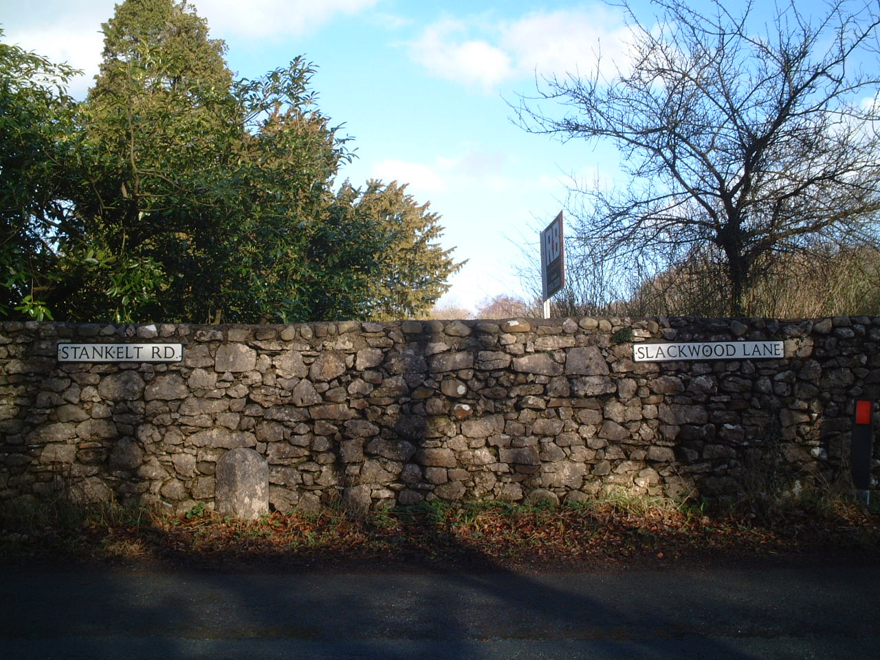 Silverdale - Lindeth boundary stone
The hamlet of Lindeth lies to the north west of the main part of Warton, and to the South of the township of Silverdale, Heald Brow, at 245ft (75 metres), is its highest point. Quicksand Pool, a stream which flows into Morecambe Bay from Leighton Moss, divides the moss land between Warton and Lindeth.
Finds including a Bronze Age sword and Roman remains show evidence of early occupation of the area. A 13th century Baron of Kendal, Walter de Lindsay, took his name from the hamlet. Farming, fishing and salt making were probably the main occupations. There is also some evidence for ship building in the 17th century and it is likely that cattle drovers, using the cross bay route, came ashore at Cows’ Mouth, the rocky inlet below Jack Scout.
Lindeth Tower at Gibraltar Farm
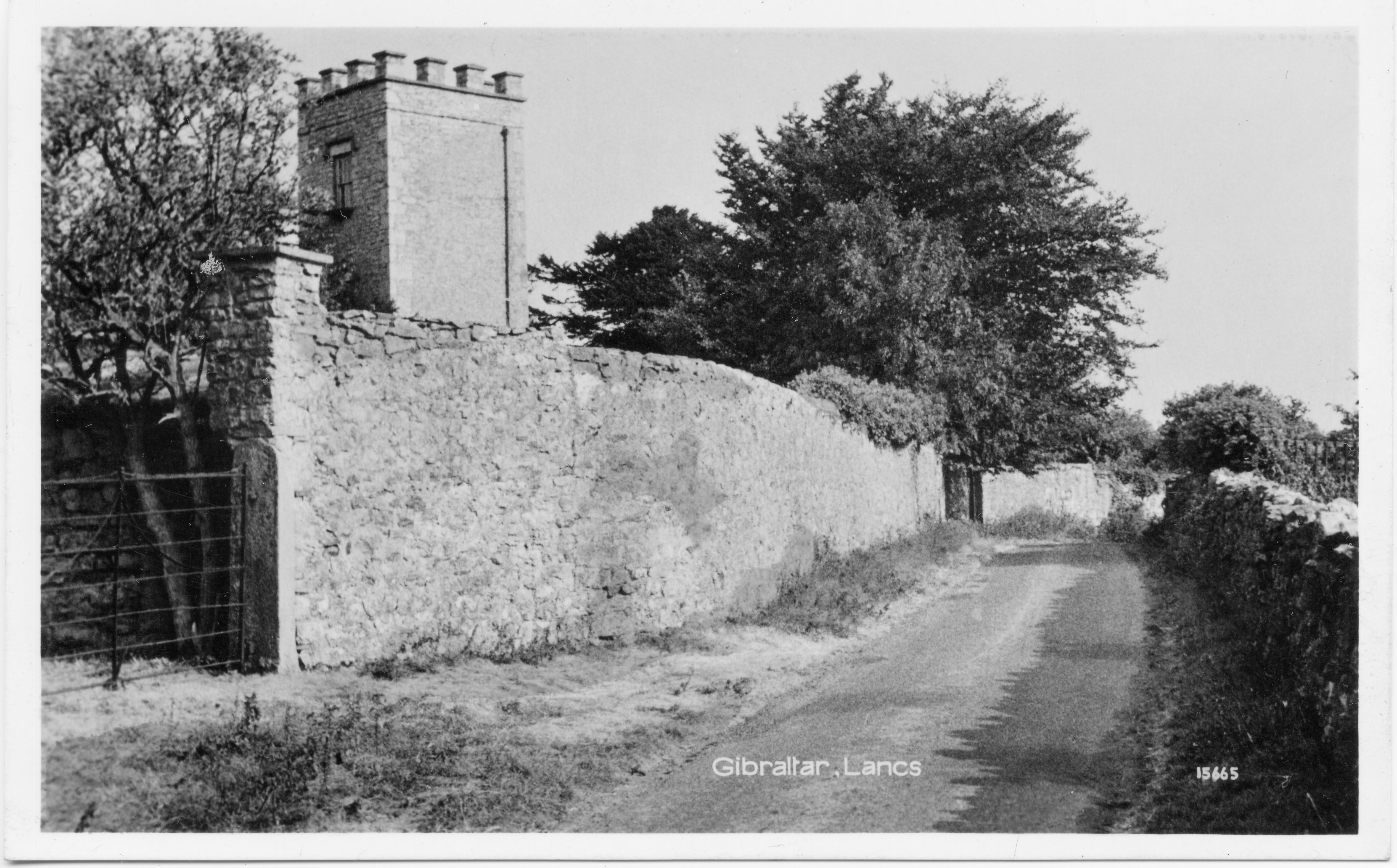 The fashion for sea bathing in the early 19th century reached Lindeth and the Britannia Hotel, now the Silverdale Hotel, provided bathing machines and one of Shore Cottages was the Bath House. Elizabeth Gaskell, the novelist spent holidays in the area and did some of her writing in Lindeth Tower, the summer house built in 1842 by Henry Paul Fleetwood, a banker from Preston, who also built Lindeth Lodge, now known as Wolf House.
Jenny Brown's Point lies at the seaward edge of the saltmarsh separating Warton Crag from Jack Scout, and contains much of historical interest. The origin of its name is uncertain, though an interesting 1984 Mourholme Magazine article (see here pages 9 and 10 - separated on this pdf file due to the copying process!) argues that it is named after a past inhabitant of the cottages located there. A tall chimney can be seen - and this is the remaining feature of a copper-smelting operation that took place between c1790 and 1800, using ores extracted from the hills above and from Warton Crag. Its short operational life evidences the paucity of minerals found locally. Close by, to the north, low tide shows the remains of a long stone embankment stretching a mile into the sea, the remains of a controversial land reclamation scheme. An Act of Parliament (1874) permitted the Warton Land Company to enclose an area stretching from Jenny Brown's Point to Hest Bank. Work began in 1875, building the embankment from limestone extracted from the quarry at Jenny Brown's Point, but proved much more difficult than had been expected by the surveyors and engineers. In 1885 the company was declared bankrupt.
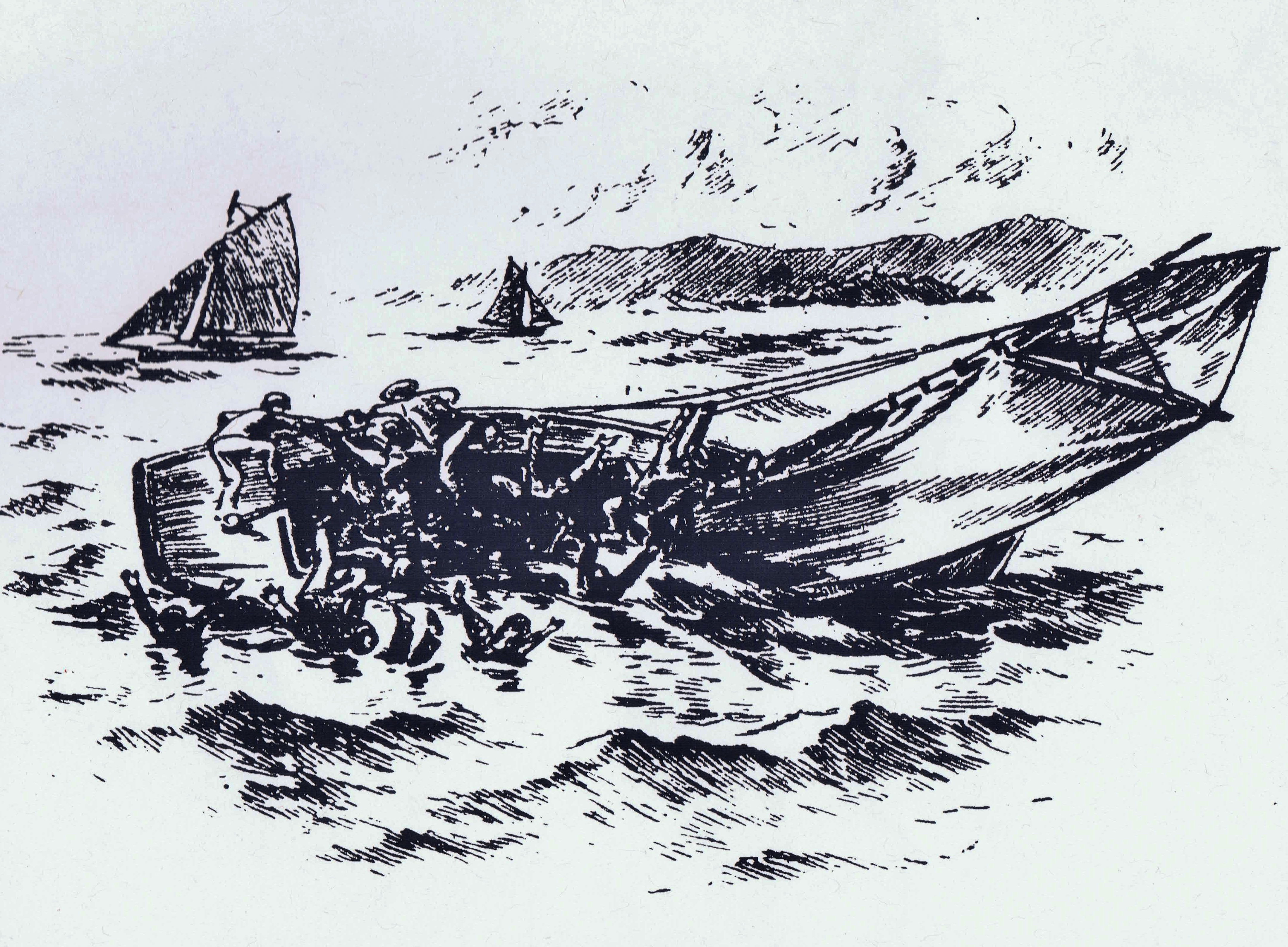 Just beyond the remains of the embankment is the site of a boating disaster - the sinking of the Matchless in 1894. A pleasure boat sailed from Morecambe with 33 passengers, taking the much-travelled route to Grange, and carrying a cargo of millworkers holidaying in Morecambe. A sudden squall caught the boat broadside, rolled the boat over, and resulted in 25 passengers drowning. 8 others, together with the boat's skipper, were saved by other pleasure boats. The inquest that followed was brief and hurried, and seemed to be something of a whitewash. The full story of Morecambe Bay's biggest ever loss of life has been researched and is published by the Society (see here).
Because of its separation from the main part of Warton, Lindeth seemed more closely allied with Silverdale and officially became part of the ecclesiastical parish of Silverdale in 1871 and part of the civil parish in 1935.
In 1801 the population of the township was 464 and fluctuated between 400 and 600 until the number exceeded 1000 in 1871 when there were 1035 people. By 1931 the population of Warton-with-Lindeth was 1694.